| william_lewis_pritchard.pdf |
Nevada Stations
The term 'stage' originally referred to the distance between stations on a route, the coach or freight wagon traveling the entire route in 'stages.' The term also came to apply to a passenger or mail coach. A stagecoach is a type of four-wheeled closed coach used to carry passengers and goods inside. It is strongly sprung and generally drawn by four or six horses. Widely used before the introduction of railway transport, it made regular trips between stages or stations, which were places where the coach's horses would be replaced by fresh horses. The fresh set of horses would be ready at the next station, so the coach could continue after a quick stop to re-hitch the new team of horses. Under this staging system, the resting, watering and feeding of the spent horses would not delay the coach. The business of running stagecoaches or the act of journeying in them was known as staging.
In 1858, John Butterfield undertook an overland stage line connecting St. Louis and San Francisco by way of El Paso, Texas. The route also ran through Tucson and Los Angeles, but neither was more than a village of a few hundred residents at that time. A federal contract paid the stage company $600,000 a year to carry U.S. mail across the continent, and that money helped subsidize way stations at regular intervals, often 12-15 miles apart, where, in the absence of existing settlements along most of the proposed route, the coaches could change draft animals and the passengers could find food. The Butterfield organization spent nearly a year getting everything into place to support semiweekly stagecoach service. There were numerous lines throughout the Old West, some figure into history more prominently than others, most notable were John Butterfield’s Overland Mail Company, Wells, Fargo & Co., and the Holladay Overland Mail and Express Company.
Stagecoach operations declined after 1869. As the railroad continued to push westward, stagecoach service became less and less in demand. With the completion of the transcontinental railroad in 1869, which revolutionized the speed of business from east to west, and points in between, transcontinental stage-coaching came to an end. Stages and wagons continued to be utilized in areas without railroad service for several more decades until the introduction of the automobile led to their demise in the 1900s.
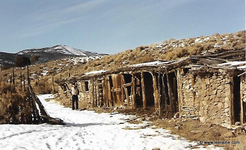
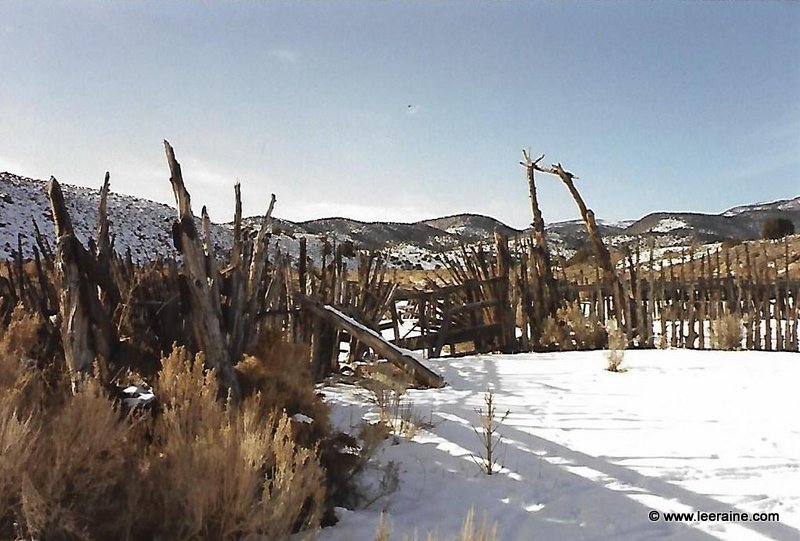
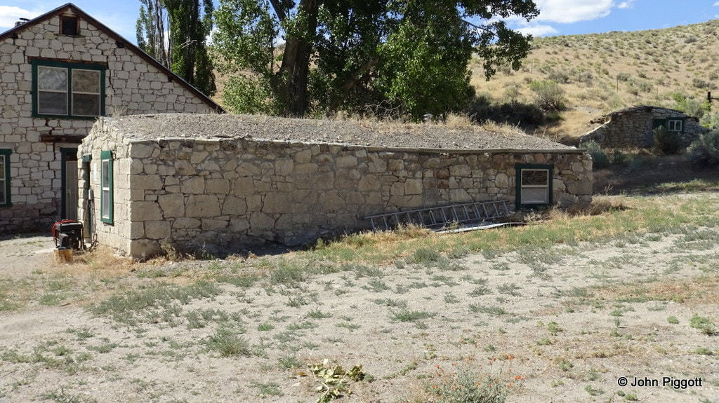
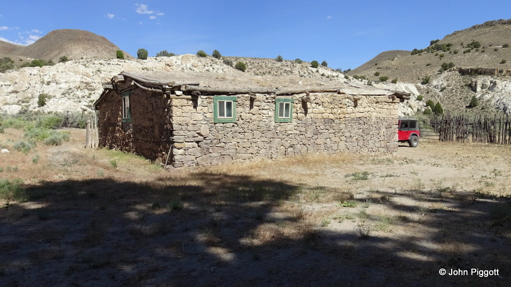
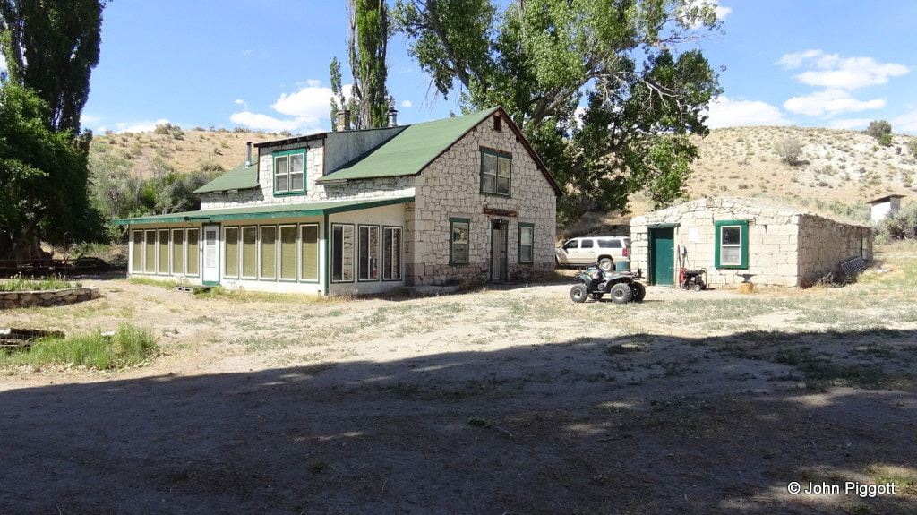
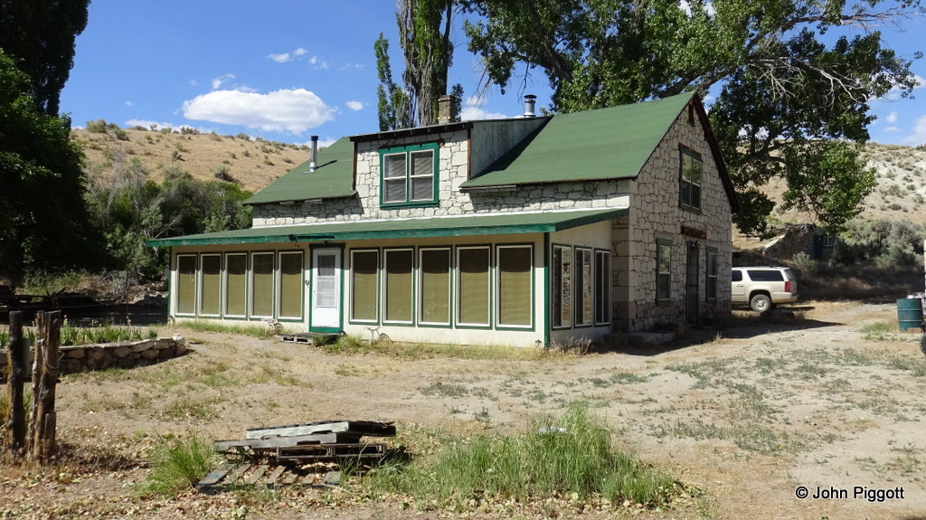
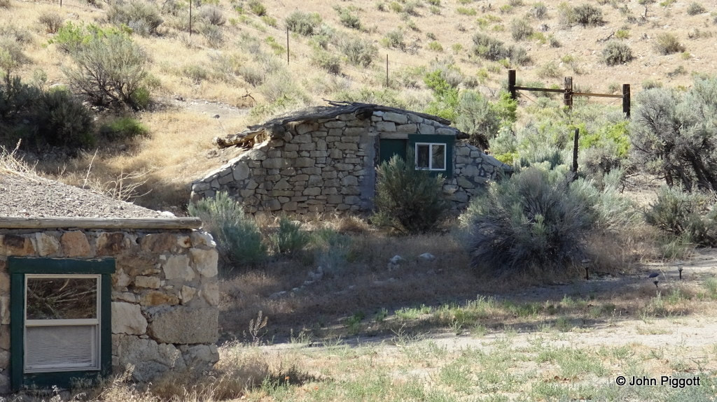
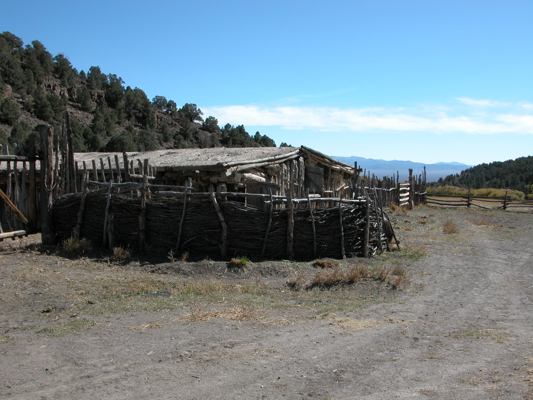
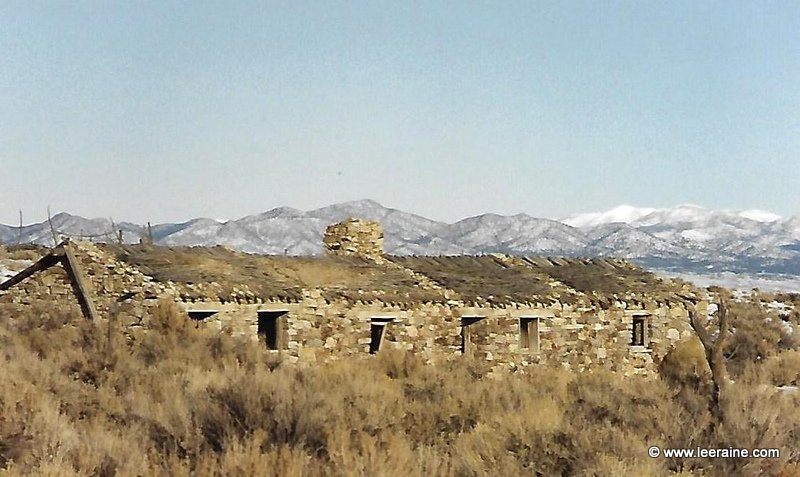
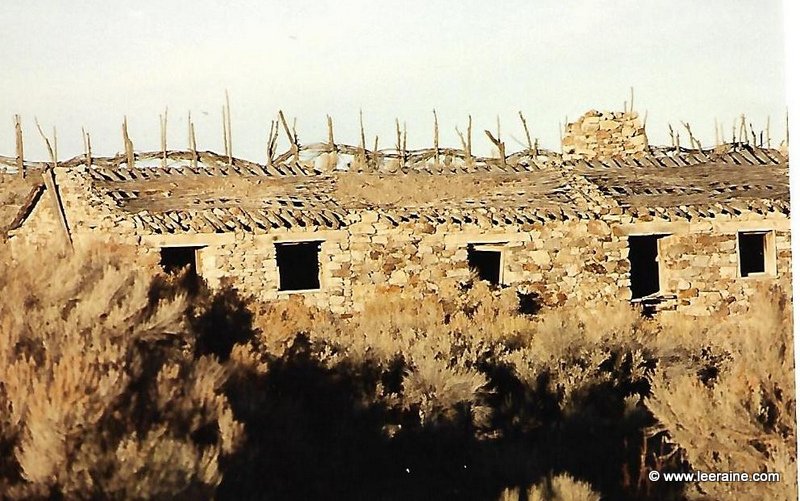
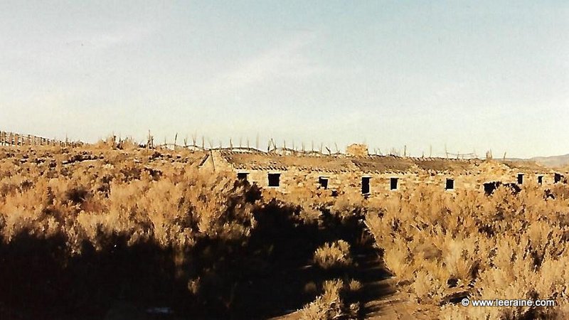
Pritchard's Station
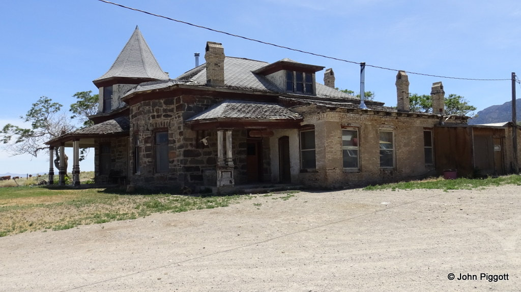
The downloadable file below is a very interesting timeline about W.L. Pritchard, the celebrated freighter who established "a freight line from Palisade direct to Pioche via Eureka, Fish Springs, Duckwater, Currant Creek and White River, leaving Hamilton a considerable distance to the eastward, thus obviating the necessity of crossing the White Pine range of mountains. The new route is from forty to fifty miles shorter than the Hamilton road and possesses the additional merit of being almost entirely level and free from snow in the Winter. Crossing over from Currant Creek to White River the road bears south along the base of the Snake range of mountains entering Pioche by Highland District and General Connors water works."
Pritchard began freighting in Sacramento and hauled rails, etc. during the construction of the Central Pacific RR. He came to eastern Nevada in about 1868 and eventually had fast and regular freight from Pioche to Eureka and then on to Palisade. He ran 20 and 26 team hitches during that time and was reported to have 2,000 mules and 500 wagons. He sold his business to the Eureka and Palisade RR in 1875 and moved back to Sacramento .
Pritchard began freighting in Sacramento and hauled rails, etc. during the construction of the Central Pacific RR. He came to eastern Nevada in about 1868 and eventually had fast and regular freight from Pioche to Eureka and then on to Palisade. He ran 20 and 26 team hitches during that time and was reported to have 2,000 mules and 500 wagons. He sold his business to the Eureka and Palisade RR in 1875 and moved back to Sacramento .
| william_lewis_pritchard.pdf |
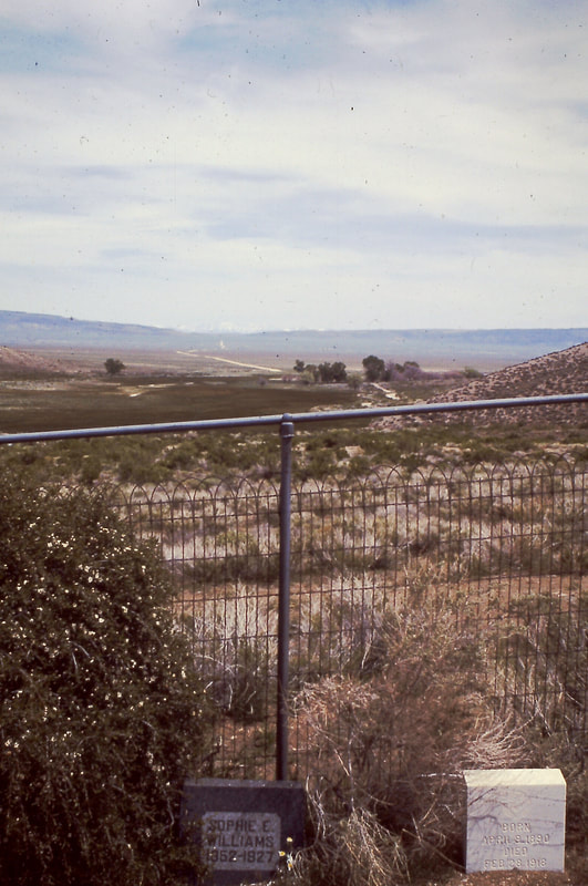
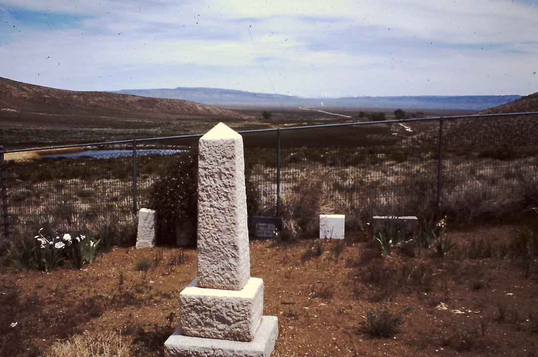
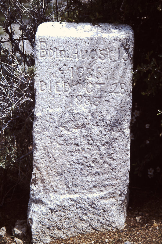
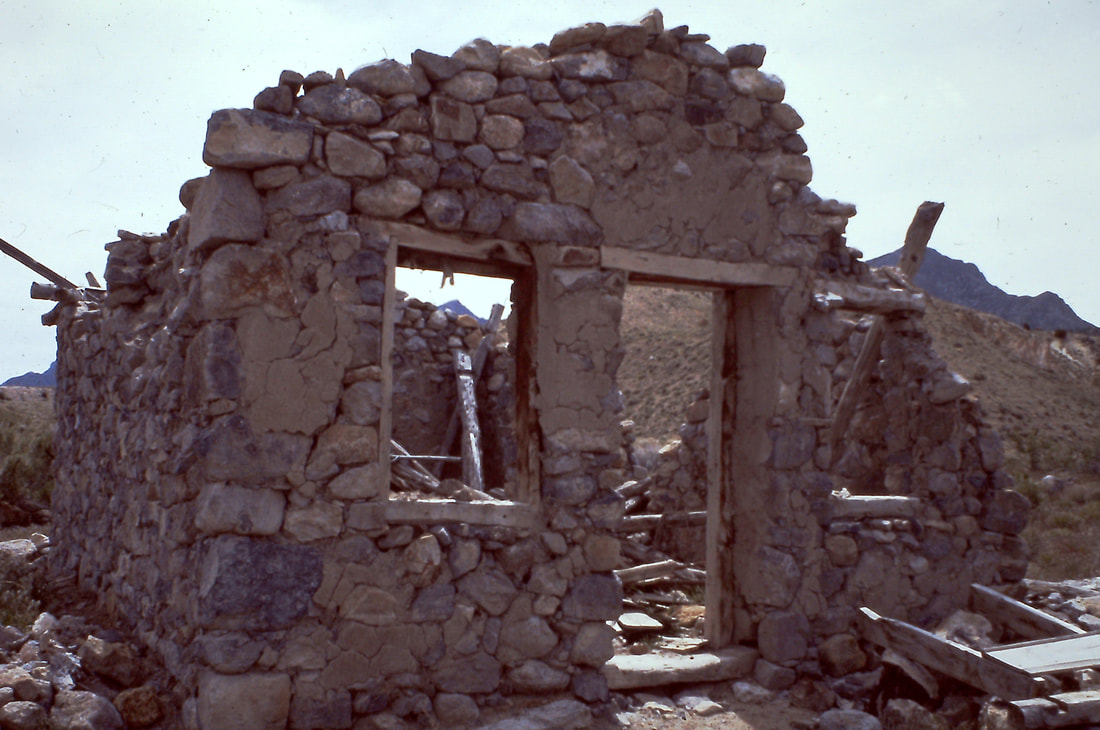
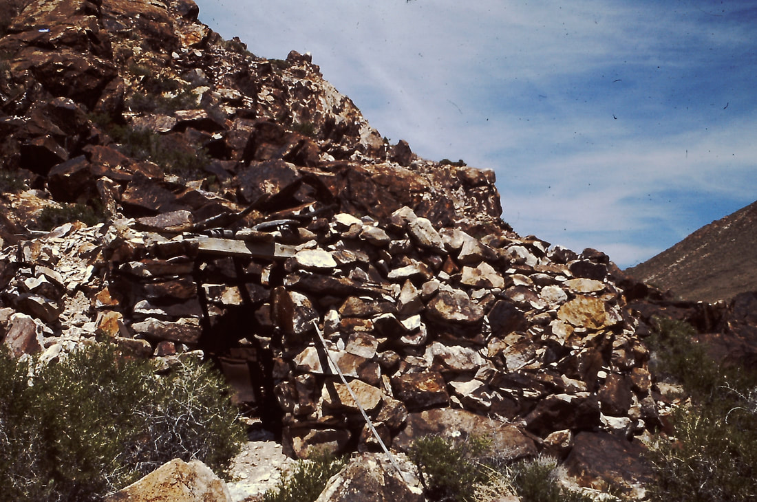
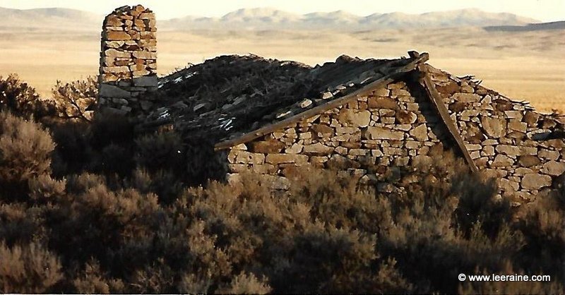
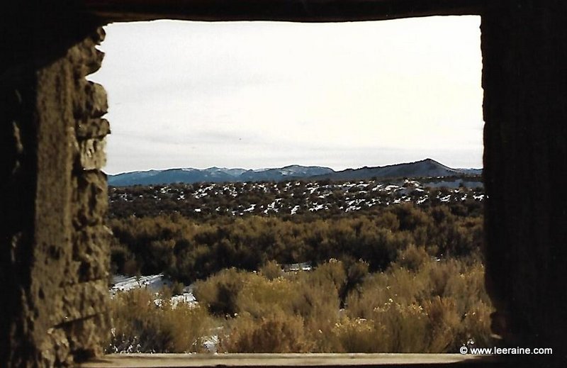
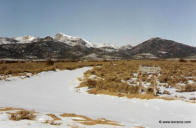
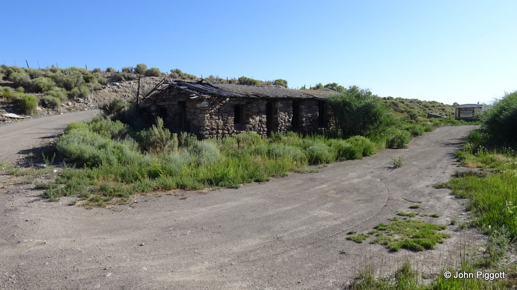
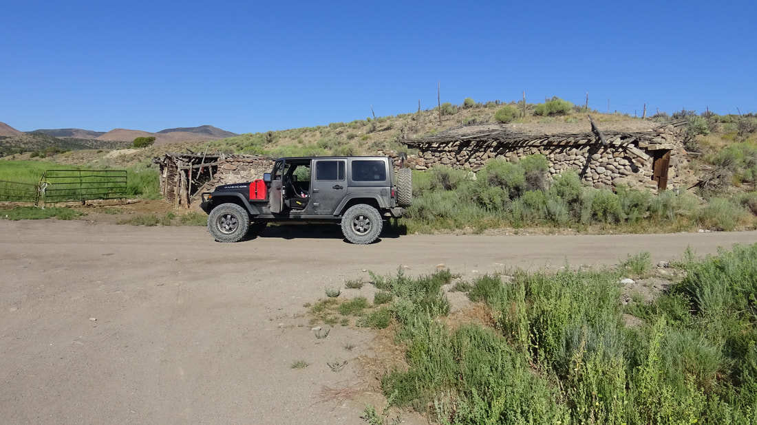
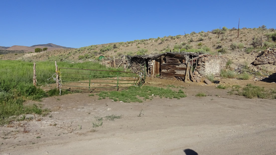
Below we have photos of some of the old freight and stage stations in Eureka County and central Nevada:
|
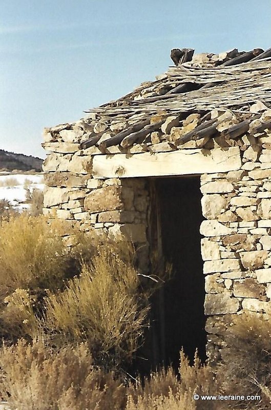
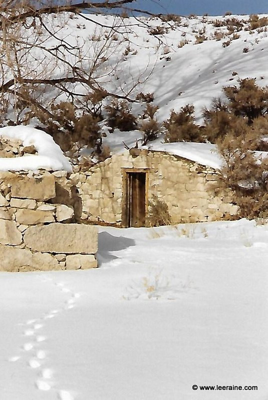
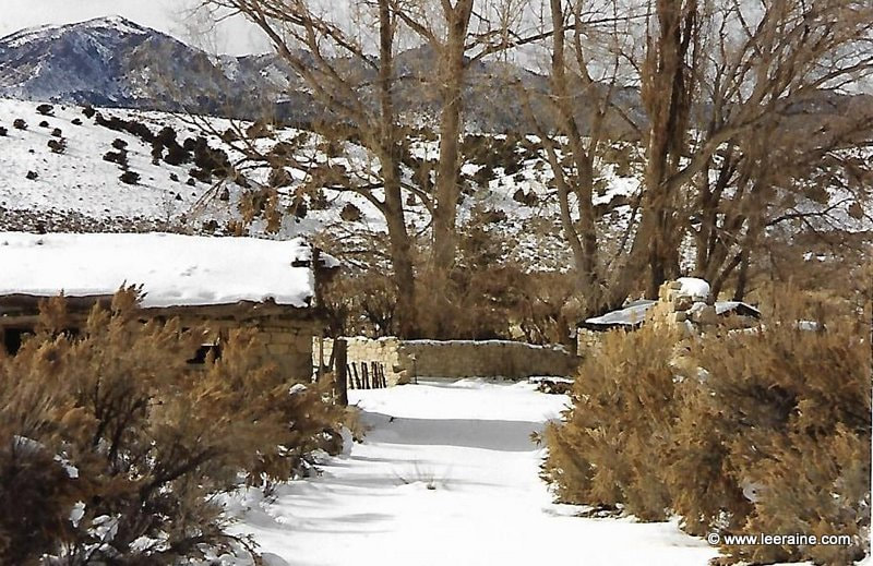
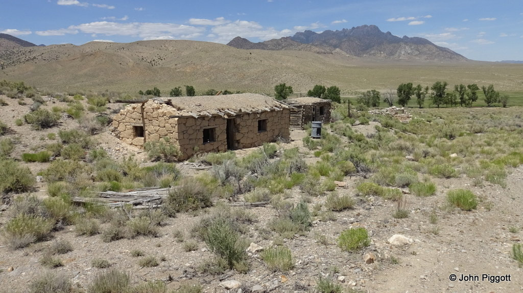
Pritchard's station was south of Eureka in Nye County on the southbound route to Pioche.
|
click on photos for larger views |
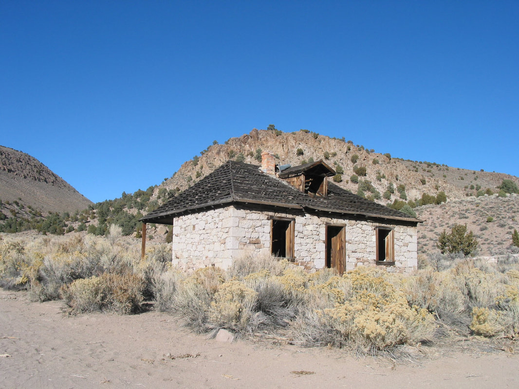
Photo by Jeanne Sharp Howerton
|
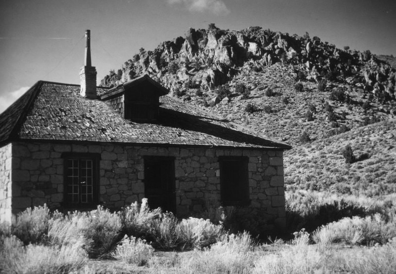
Photo by Kenneth H. Pritchard
|
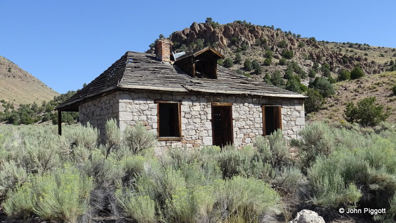
Photo by John Piggott 2019
|

Photo by John Piggott 2019
|
|
Pritchard information shared with us by Duane Bartholomew and Jeanne Howerton. Howerton says, "I have recently coauthored a book on Tybo and Hot Creek that was published in September 2016. The book has a lot of information and photos about the surrounding area (Moore Station, Hicks Station, Pritchard Station, etc) and how it all ties into Eureka and Palisade and the whole development of the Hot Creek Range. The book is available from the Central Nevada Museum in Tonopah, OR you can get one from the Sentinel Museum in Eureka. The title is: Tybo, Nevada: Gem of the Sagebrush Frontier."
|
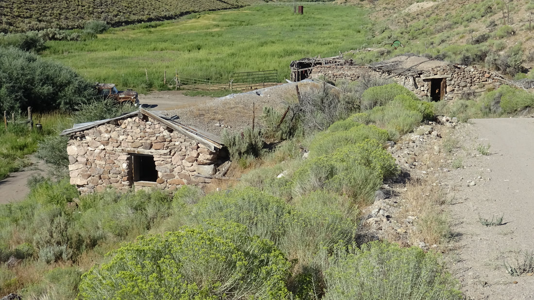
Moore's Station
Photos below Lee Raine circa 1993

In the early 1870s, the four Moore brothers settled here and established a small ranch. Shortly after, it became a stage stop on the Belmont-Tybo-Eureka stage run. The brothers dug a small reservoir, brought in a number of fruit trees, and established one of Nevada’s first orchards. After the stage stopped running in the 1880s, the station had little purpose and it was finally abandoned. In the late 1990s it was restored into a private residence.
Moore's Station Photos and narrative below summer of 2020 by John Piggott
From Hot Creek, as we finally came to Moores Station, we completed our connection to the first half of the stage route which we had unknowingly traced from Eureka a year earlier.
Moores Station:
In the early 1870s, the four Moore brothers settled here and established a small ranch. Shortly after, it became a stage stop on the Belmont-Tybo-Eureka stage run.
It became a stage stop in 1875 on the Belmont-Tybo-Eureka line. A nearby spring provides plenty of water to form a beautiful oasis of green in the dry desert. Moores Station even had one of the first orchards in Nevada, which still bears fruit today.
Later, when the stagecoach line was abandoned the beautiful two-story stone building was used as a ranch house for a while. In the late 1990s Moores Station was restored, and converted to a private residence. Besides the beautiful station house there are several other stone buildings nearby. If you visit, please note that this is private property.
I guess I’ll never know for sure whether we had actually retraced the original route of the Belmont-Tybo-Eureka stage line. But I think it’s safe to say the stage company would probably not have chosen a significantly different route causing it to traverse greater distances and more difficult terrain. In any case, it was a great adventure with lots of fun and interest, and a very good history lesson about frontier Nevada.

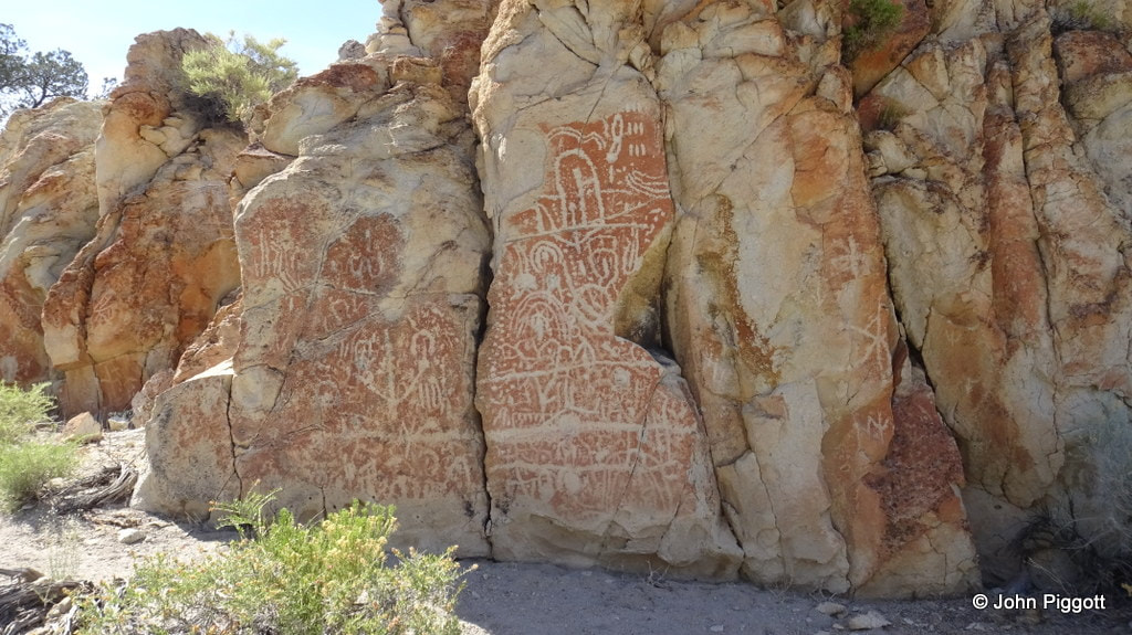
Moore's Station Petroglyph site

In 1860, there were about 157 Pony Express stations that were about 10 miles apart along the Pony Express route, a number of them in Nevada. Highlighted ones below are in Eureka County.
|
139. Reese River/Jacob's Spring Station
140. Dry Wells Station 141. Smith's Creek Station 142. Castle Rock Station 143. Edward's Creek Station 144. Cold Springs/East Gate Station 145. Middle Gate Station 146. West Gate Station124. Prairie Gate/Eight Mile Station 125. Antelope Springs Station 126. Spring Valley Station 127. Schell Creek Station 128. Egan's Canyon/Egan's Station 129. Bates'/Butte Station 130. Mountain Spring(s) Station 131. Ruby Valley Station 132. Jacob's Well Station 133. Diamond Springs Station 134. Sulphur Springs Station 135. Roberts Creek Station 136. Camp Station/Grub(b)s Well Station |
137. Dry Creek Station
138. Simpson Park Station 147. Sand Springs Station 148. Sand Hill Station 149. Carson Sink/Sink of the Carson Station 150. Williams Station 151. Desert/Hooten Wells Station 152. Buckland's Station 153. Fort Churchill Station 154. Fairview Station 155. Mountain Well Station 156. Stillwater Station 157. Old River Station 158. Bisby's Station 159. Nevada Station 160. Ragtown Station 161. Desert Wells Station 162. Miller's/Reed's Station 163. Dayton Station 164. Carson City Station 165. Genoa Station 166. Friday's/Lakeside Station |

Pony Express Trail Marker
| |||
Dry Creek


Willow Creek - Antelope Valley
Willow Creek rujns: Photos below summer of 2020 by John Piggott

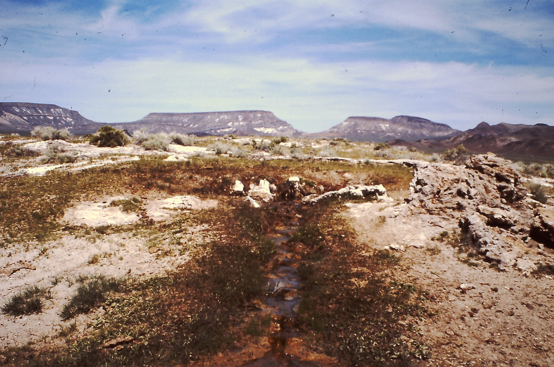
Hot Creek
Date Settled: 1866
Founded in the 1860s, the town was both a mining camp for nearby mines and an important stop for freight stage traffic to nearby mining centers like Tybo. The town of Hot Creek was said to be divided into an upper and lower camp and each had a stamp mill, although neither mill operated much. As the name implies, Hot Creek was built near hot springs, and in the 1800s these springs became popular with residents of nearby mining camps. The town was the property of J. T. Williams and was the site of a very elaborate stone building which served as an unusually ornate hotel to serve wayfarers.This building, later gutted by fire, was restored in the early 1900s. It is said that Williams made a sizeable stake from an early discovery in the Danville district, with which he purchased and improved the Hot Creek site. The town is reported to have had a population of 300 in 1868, but is said to have dropped to 25 in 1881.
At some point the town of Hot Creek was abandoned and the site became known as the Hot Creek Ranch. The hotel survived as the ranch house and still stands.

Graveyard at Hot Creek